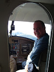
 Today's flight was a real learning experience. Some of the lessons were big and some were tiny little things. For example, immediately after finishing the flight, I walked around the corner from Bay Air to Pilot Mall and purchased a knee board. I had more trouble keeping my charts and flight plan organized than flying or finding my checkpoints. It's a small lesson that makes a big difference.
This was a beautiful day for flying. We cruised at 2500 feet from Albert Whitted to Crystal River (CGC). Climbing out of Whitted and Crystal River, we had some pretty strong turbulence, but once at altitude the air was smooth. I could mostly fly with my hands off of the yoke, just using the rudder to make small course corrections and making minor trim adjustments as needed.
Rob check my flight plan before we left. I had my wind correction angle wrong on the trip out. Other than that, it was good. We recorded the time at all the checkpoints and checked estimated against actual ground speed. We had more wind aloft than forecasted. Our trip north was slower, and the return trip was faster than planned. The only thing I was unhappy with was my landing at Crystal River. The north-south runway at Crystal River is grass and Rob wanted to land on the pavement. The difficulty was the 10 knot wind directly out of the north. Great. 9/27 at Crystal River is long (4555 feet) but only 75 feet wide. That 75 feet goes by pretty fast when you're drifting in a 10 knot crosswind. Rob got on the controls and put more aileron into the wind and I set her down on the left side of the runway. I would like to have taken a couple trips around the pattern and tried that again, but we headed back to Whitted.
 The return trip was uneventful. After adjusting for the wind, we hit the checkpoints on schedule. Landing at Whitted, a Coast Guard Jayhawk helicopter (not my photo, borrowed from another web site) did a touch and go in front of us, so we flew through his wake/rotor wash on final. That bounced us around a bit and is the reason for the long slow turn from downwind to final, if you bother to look at the GPS track.
I'm to fly the trip to Crystal River solo next. I may practice again before I fly the solo cross country. After that, VOR navigation and a longer supervised cross county. I'm getting close to being free to fly new places on my own. Too cool. By the way, Rob and I were talking about the cross wind while we were at Crystal River, and I forgot to fly north to the springs and get photos. Next time I won't forget. The photo at top was one of my checkpoints, the inlet at the Chassahowitzka National Wildlife Refuge. That's a mouth full.
You'll need google earth to open and view the lesson 15 flight track.
Statistics
Dual Instruction Time: 15.1 Hours
Solo/PIC Time: 5.4 Hours
Landings: 82


2 comments:
Very cool! Congrats on your first cross-country flight! My first will be this Friday afternoon from Tampa North up to Leesburg and then Ocala and back.
Glad to see you enjoyed your first trip somewhere else! It really is a whole different (and refreshing) experience to just fly somewhere instead of practicing maneuvers, isn't it?
Post a Comment